This SOP will detail how to create and share construction advisory maps.
Create Construction Advisory Map
- Login to the Adminstrative ArcGIS Online portal at https://trecs.maps.arcgis.com/home/index.html
If you are authorized to update construction advisory information your username and password will be shared with you via https://stache.utexas.edu/ - Click on the Construction Advisory Map under the Inside UT GIS banner:

- Zoom into the construction zone for which you would like to create/modify construction advisory information:

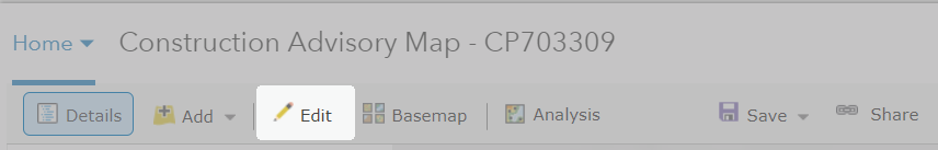
- To create new pathways click the edit button at the top of the map
- The pane to the left of the map will change to "Add Features".

- Click the construction advisory object you wish to add, move your cursor to the map window, and follow the tool tips provided.
- Click to start drawing
- Click to continue drawing
- Double-click to complete
- Once you complete geometry you will receive a popup window that looks like below:

- If you wish to change the category use the drop down arrow.
- enter notes as applicable
- Close or delete the object.
- When add edits are complete click the Edit button again to return the previous left-hand side display.
- If you need to edit an object click the object in the map to active its pop-up and click the Edit link at the bottom.

- Change the category, notes as needed or delete the object.
- To change geometry click close, zoom into the object and use the white dots to create new vertices and the grey dots to re-position vertices.


- When add edits are complete click the Edit button again to return the previous left-hand side display.
- Save your map when done!!
Share Construction Advisory Map
- For convenience Sue will provide you with the URL to add to your construction advisory page.