About Settings Tab

Settings contains information about an items settings including delete protection, editing ability, and item extent settings. This page shares locations and explanations of the features available in the Settings tab. More detailed step-by-step guides such as enabling editing and changing a items extent can be found in LIS Resources.
Features General
Features Web Map
Features Feature Layer

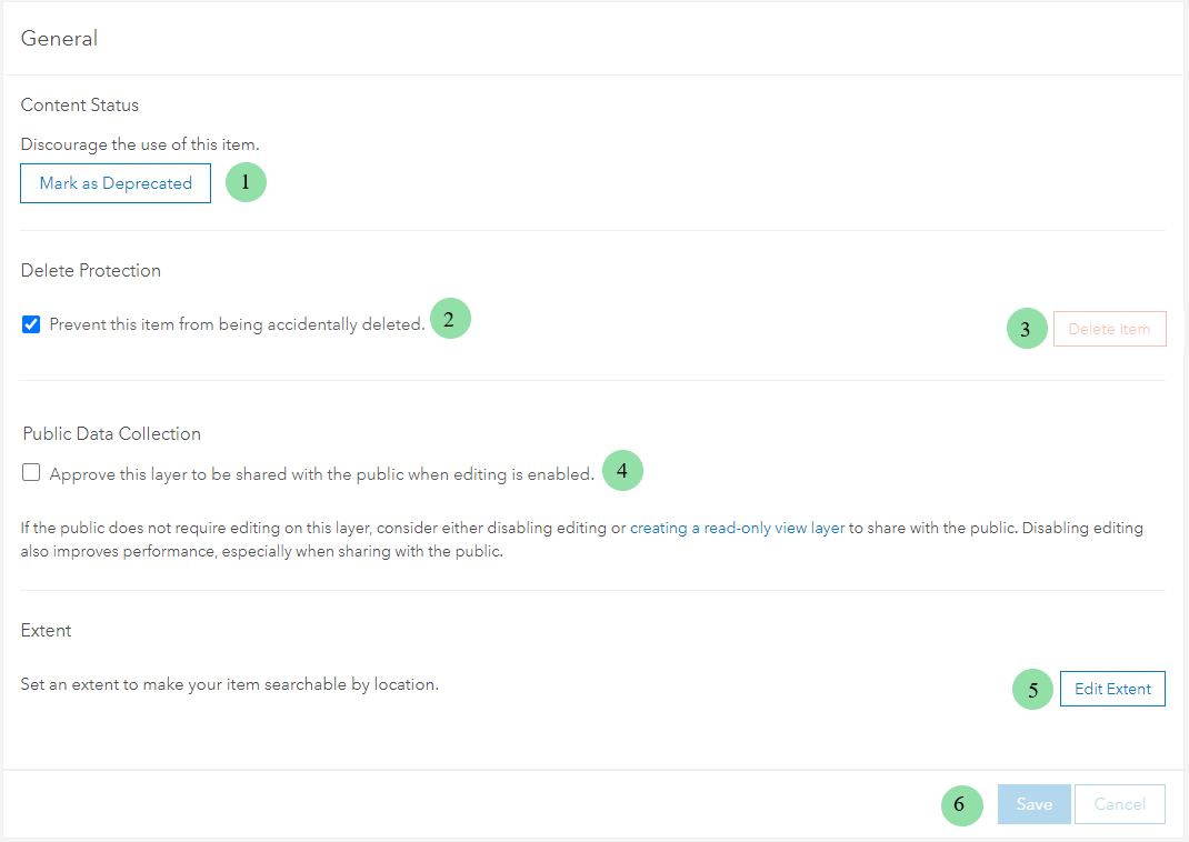
- Click Mark as Deprecated to discourage users from using the item.
- Click the check box bellow Delete Protection to prevent item form being accidentally deleted.
- Click Delete Item to permanently delete item.
- Click check box bellow Public Data Collection to allow item to be publicly edited (edited by anyone).
- Click Edit Extent to change the items default extent.
- Click Save to save any changes made under General.
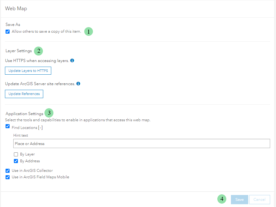
- Click check box below Save As to allow others to save a copy the item.
- Layer Settings allows HTTPS use (extra security) and updates ArcGIS Server site references (switch between server site).
- Application Settings allows item to be used in mobile like Field Maps.
- Click Save to save any changes made under Web Map.
- Editing Settings determines who can edit, what is editable, editor tracking, and viewable edits.
- Select the box bellow Optimize Layer Drawing to enable vertex editing.
- Click Rebuild Index to improve item drawing performance.
- Cache Control determines how the items cache is updated.
- Click check box below Export Data to allow item to be exported by other users.
- Click Save to save any changes made under Feature Layer.